About Center
The Scientific and Educational Center for Unmanned Aerial Systems is a specialized platform that combines education, scientific research, and the development of innovative solutions in the field related to unmanned aerial vehicles (UAVs). The center actively collaborates with other organizations to address applied tasks in the areas of monitoring, cartography, resource exploration, agriculture, and security.
The mission of the center is to promote the development and implementation of unmanned aviation technologies in key sectors of the economy through the training of professional personnel, the conduct of applied scientific research, and the creation of technological solutions.
The center operates more than 9 unmanned aerial vehicles designed to tackle tasks of varying complexity. The UAVs are equipped with modern payloads, including hyperspectral and thermal cameras, LiDARs, ground-penetrating radars, spectroradiometers, aeromagnetometers, and other specialized equipment. These systems are used for monitoring industrial and infrastructure facilities, the agro-industrial complex, environmental control, as well as for geophysical studies and mineral exploration.
Goals and tasks
Goal:
The goal of the Scientific and Educational Center for Unmanned Aerial Systems is to establish an educational and research base for the effective application of unmanned aerial systems across various industries.
Key objectives of the Center:
-
Conduct scientific and applied research using UAVs and various payloads;
-
Utilize unmanned systems for monitoring in industry, agriculture, environmental protection, and geological exploration;
-
Apply specialized sensor payloads (hyperspectral and thermal cameras, LiDARs, ground-penetrating radars, spectroradiometers, aeromagnetometers, etc.) to solve practical problems;
-
Collaborate with scientific, educational, and industrial organizations;
-
Participate in pilot projects, fieldwork, and demonstrations of UAV capabilities;
-
Promote the use of UAVs through educational and outreach initiatives.
Services
The Scientific and Educational Center for Unmanned Aerial Systems provides a wide range of services in aerial monitoring and data processing using unmanned aerial vehicles (UAVs) equipped with high-tech sensors and instruments.
List of services provided:
-
Hyperspectral Imaging
— Assessment of vegetation condition, detection of soil and water pollution, mineralogical surface analysis, crop yield estimation, and land mapping. -
Thermal Imaging
— Thermal monitoring of industrial and energy facilities, detection of heat leaks and insulation defects, inspection of buildings and structures, and monitoring of power lines. -
LiDAR Surveying
— High-precision 3D terrain mapping, relief modeling, monitoring of ground surface deformations, and engineering-geodetic surveying. -
Aeromagnetic Surveying
— Geophysical exploration for mineral deposits, detection of magnetic field anomalies, and support for mineral prospecting. -
Ground-Penetrating Radar (GPR) Surveying
— Inspection of underground utilities, detection of engineering structures and voids, and determination of subsurface layer depths. -
Spectroradiometric Measurements
— Precise analysis of surface reflectance properties, biosphere monitoring, and assessment of ecosystem health. -
Photogrammetry and 3D Modeling
— Creation of digital models of terrain, architectural objects, and industrial sites for further analysis and planning. -
Environmental and Industrial Monitoring
— Regular site inspections, emission control, and assessment of environmental and industrial facility conditions.
All services include professional data processing, analytical reporting, and visualizations.
Innovation projects


Goals
Assessment of the resource potential of the livestock industry
Tasks
- understand the principles of rangeland management and how this knowledge is used in assessing the health of rangelands;
- gain basic skills in assessing the productivity of dedicated lands;
- understand the basic principles of using geographic information systems and remote sensing to estimate annual pasture production;
- gain skills in estimating the initial indicators of livestock for grazing livestock and assessing feed budgets for the year and production or regional scale;
- gain insight into the inputs and outputs of the rangeland and erosion hydrology model, and how to use this tool to assess the sustainability and conservation of rangelands.


Goal
Using accurate spatial maps of historical flood zones based on high-resolution remote sensing and digital elevation models (DEM), develop an empirical water load index (WaSSI) model. Set up a hydrological model of the research site, and a soil and water assessment tool (SWAT), to predict spatial and temporal changes in flood zones and affected areas under various climate and land use scenarios in the example of the city of Almaty.
Tasks
- Create a comprehensive, high-resolution geospatial database for GAR (1980s–present).
- Create a map of historical flood zones along the main rivers/lakes in the BAL and evaluate key parameters for the models.
- Conducting seminars and training on the project for land surveyors, politicians, teachers, and students from Kazakhstan.
- Conduct a comprehensive flood assessment through vulnerability analysis and identify hot spots that require proactive planning.




Goal
- To quantify interdependent changes in food production, total evaporation, and radiation balance in Kazakhstan and Mongolia during 1981-2020, as well as to identify socioeconomic and physiological factors responsible for the change, through empirical and mechanical studies and their modeling;
- To assess the direct effects of land-use change, total evaporation, and albedo in remote sensing with a resolution of 30 m scaling, and to identify the indirect impacts of infrastructure (e.g. road networks, transport, technology), livestock/farmers' demographics, policies and climate in the three selected areas in each country;
- To study the direct impact of management practices on land use, as well as the results of FEW through manipulative field experiments on landscapes dominated by crops and grasslands.
Goal
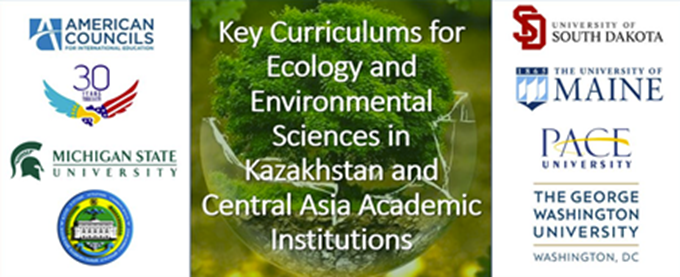
Exchange and revision of curricula of core courses required for ecology and environmental sciences for several higher education institutions in Kazakhstan.
Tasks
- Organize an intensive seminar on the curriculum, for teachers of various higher educational institutions of the United States and Kazakhstan. In order to ensure the long-term sustainability of new training programs by Kazakhstani participants;
- Establish direct communication between faculty in U.S. and Kazakhstan institutions, which will help ensure continued communication after the workshop, as well as facilitate long-term cooperation in environmental research and education;
- Prepare a set of curricula, handbooks and other educational materials in conjunction with teachers of a US university that can be used in higher educational institutions of Kazakhstan.


Goal
This proposal is designed to study the empirical and mechanical impact of land use and climate change on the rate of drying up of the Aral Sea, which has become one of the most serious environmental disasters since 1960. Our premise is that excessive water abstraction, intensification and expansion of both rangelands, redirection, and management of water flows, and changes in vegetation cover outweigh the impact of climate. Scientific efforts to identify human contributions and climate need to focus on an adjacent sea catchment basin, such as the Syr Darya River Basin (SRP), which is the largest watershed of the Aral Sea.
Tasks
- Creation of a comprehensive database on climate, ecosystems, LULCC, economic measures, social values, and policies since 1970 (i.e. the beginning of images) at two administrative levels (Kzyl-Orda region and three districts in debt of the Syr Darya River);
- Study of Interdependent Changes in Food, Energy, and Water (FEW) for the Kyzyl-Orda region and three districts using high-resolution data for the mechanical understanding of related changes in climate and Aral Sea level;
- Identification of critical driving forces on the surface of the earth, including changes in control, in river flows and the study of level changes;
- Creation of a web page with open access for the exchange of all data and research results.
6. Evaluating the effectiveness of various land cover/use systems to mitigate climate change by reducing greenhouse gas emissions and increasing albedo



Goal
To assess the emission of greenhouse gases (CO2, CH4, N2O) and albedo in arable soils in the example of the Almaty region when using fertilizers (manure, mineral fertilizers, and control) when applying various types of basic tillage for different crops (wheat, corn, and barley).
Tasks
- To assess the emission of greenhouse gases (CO2, CH4, N2O) and albedo in arable soils when using fertilizers and applying different types of basic tillage for different crops;
- Understand and assess how much our traditional and effective methods affect emissions and mitigate the negative impact of agriculture on global climate change.
7. KendyrTex, CLIENT II, 2022-2023
Goal
Reclamation of saline arable land in Central Asia with adapted non-food crops (Kendyr Apocynum pictum), as well as textile value added as an alternative to cotton.
Tasks
- Study of the cultivation of "Kendyr Apocynum pictum" for the possible production of fiber in quality comparable to cotton,
- Development of effective, climate- and location-adapted methods of cultivation and harvesting;
- To develop additional fibrous raw materials for the growing textile market.
Structure
The Scientific and Educational Center for Unmanned Aerial Systems has a flexible and multifunctional structure that enables effective solutions across a wide range of areas. The center operates through several specialized teams, each possessing a high level of expertise in its domain. This allows us to deliver comprehensive solutions for various sectors of the economy and successfully execute even the most complex projects.
Center Teams:
-
Research and Development Team
Conducts scientific research, analyzes collected data, and integrates new technologies into UAV operation processes. Specialists in this team work with cutting-edge sensors and payloads to achieve highly accurate and relevant results. -
Geophysical Team
Focuses on geophysical surveys using aeromagnetometers, ground-penetrating radars, and other specialized tools to search for mineral deposits, analyze soil structures, and detect subsurface objects. -
Data Processing Team
Responsible for processing and analyzing data collected by UAVs. This team includes experts in image processing, 3D modeling, and analytical reporting, enabling clients to make informed decisions. -
Engineering Team
Provides technical support and system configuration, ensuring uninterrupted operation of UAVs and sensors and compliance with mission requirements. -
Environmental Monitoring Team
Specializes in environmental condition monitoring using various sensors such as hyperspectral cameras, thermal imagers, and spectroradiometers. -
Geodesy and Cartography Team
Specializes in creating accurate maps and 3D terrain models using UAVs. This includes topographic surveys, cadastral mapping, and infrastructure design.
Each of these teams possesses deep knowledge and practical experience, allowing the center to successfully tackle tasks of any complexity while adapting to client needs across different industries.
Publications
01) Kolluru V., John,R., Chen J., Xiao J., Goljani A. R., Giannico V., Kussainova M. Optimal ranges of social-environmental drivers and their impacts on vegetation dynamics in Kazakhstan. Science of the Total Environment, https://doi.org/10.1016/j.scitotenv.2022.157562
02) Kolluru V., John,R., Chen R., Jarchow M., Goljani A.R., Giannico V., Saraf S., Jain K., Kussainova M., Yuan J. Untangling the impacts of socioeconomic and climatic changes on vegetation greenness and productivity in Kazakhstan. 2022 Environ. Res. Lett. 17 095007, https://doi.org/10.1088/1748-9326/ac8c59
03) Matsui K., Akhapov Y., Kussainova M. (2017). Management of wood resources: A dilemma between conservation and livelihoods in a rural district in the Aral region. Energy for Sustainable Development 41: 121-127, DOI:10.1016/j.esd.2017.08.010
04) Matsui K., Watanabe T., Kussainova M., Funakawa S. (2018). Soil properties that determine the mortality and growth of Haloxylon aphyllum in the Aral region, Kazakhstan. Arid Land Research and Management 33: 37-54, DOI:10.1080/15324982.2018.1496187
05) Starodubtsev V. Kussainova M. (2018). Spatio-temporal development of deltaic landscape in the Kapchagai reservoir and methods of its study. Environment and Soil Resources Conservation: book of proceedings 10th International Soil Science Congress, Almaty.
06) Kussainova M., Pachikin K., Erokhina K. (2016). Distribution, typology and assessment of degraded soils Piedmont Plains Zhetysu Ridge, Kazakhstan. Eurasian Journal of Soil Science 6 (2):178 – 188.
07) Chen, J., Z. Ouyang, R. John, G. M. Henebry, P. Groisman, A. Karnieli, M. Kussainova, A. Amartuvshin, A. Tulobaev, E. T. Isabaevich, C. Crank, L. Tian, A. Kadhim, J. Qi, and G. Gutman. 2020. Social-Ecological Systems across the Asian Drylands Belt (ADB). In Gutman et al. (Eds.), Land-Cover and Land-Use Change in Drylands of Eurasia, Springer 978-3- 030- 30741-7, 439140_1_En, (10)
08) Kussainova M., Spaeth K., Zhaparkulova E. (2020) Efficiency of using the rangeland hydrology and erosion model for assessing the degradation of pastures and forage lands in Aydarly, Kazakhstan. Eurasian Journal of Soil Science 9(2) 186- 193. DOI: 10.18393/ejss.708898
09) Kussainova M., Durmuş M., Erkoçak A. (2013). Soil dehydrogenase activity of natural macro aggregates in a toposequence of forest soil. Eurasian Journal of Soil Science 2 (1): 69 - 75.
10) Kussainova M., Tauschke M., Saparov A. (2014). The Effect of Applying the Microbiofertiliser “MERS” on the Soil Microbial Community and the Productivity of Winter Wheat Under the Conditions of Southeast Kazakhstan. NovelMeasurement and Assessment Tools for Monitoring and Management of Land and Water Resources in Agricultural Landscapes of Central Asia. Springer, Cham.
11) Mikailsoy F., Kussainova M., Er F. (2018). The Proceedings of the 10th International Soil Science Congress on “Environment and Soil Resources Conservation”.
https://scholar.google.com/citations?user=GIeEurMAAAAJ&hl=ru
Employees
Tamenov Timur Borisovich
Head of Aviation Works
Master of engineering and technology
Yerzhan Dilmurat
Researcher
Master of agricultural sciences
